Inverse topography is visible in the central foothills of the Sierra Nevada as flat-topped mountains shaped like rivers. These topographic feature are particularly visible as one drives between Oakdale and Sonora on Highway 108/120, their steep dark bluffs stand out against the otherwise rolling grassy oak woodland landscape. We know that these features are formed when hot volcanic debris flow downhill, naturally following river channels, cool and harden to a material which is more erosionally resistant than the surrounding substrate.
What, however, are the potential legacies of these deposits in the higher in the bedrock watershed, where they do not persist as formations, but drive the evolution of a landscape over the course of millennia and are eventually eroded away. As a chapter in the forthcoming natural history of the Tuolumne Watershed book points out, these pyroclastic debris flows did have an effect on the evolution of the watershed. What I am wondering here, which I’m sure many good geologists could answers for me, is how.
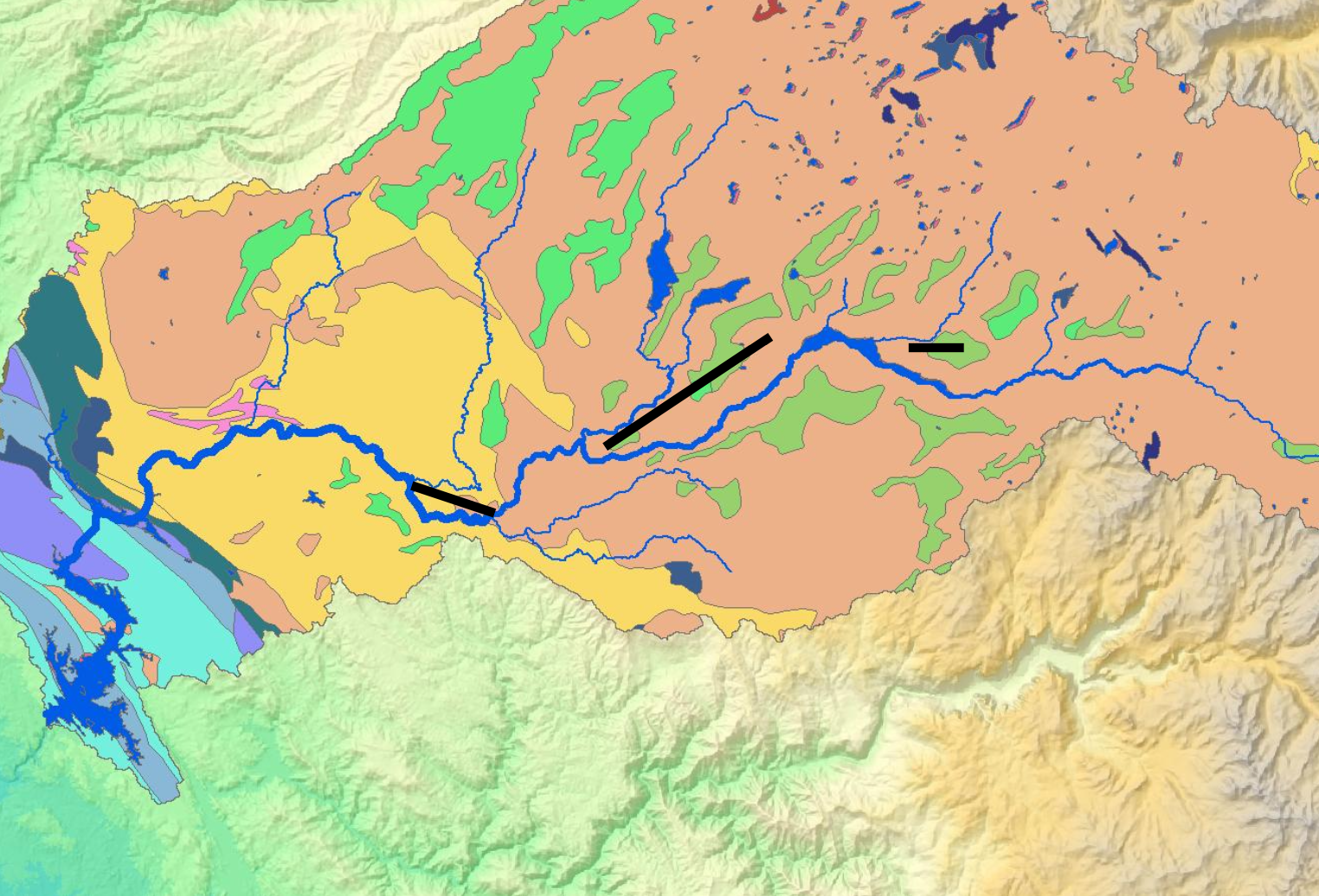
Earlier in this academic quarter I postulated that the Cenozoic volcanic rocks, visible in the figure below as light green, were located on ridges between the North Fork, Clavey, and Cherry Creek drainages, as an example of inverse topography. These volcanics surely did flow down the lowest point of the mountainside as they were extruded, 65 million years ago.
But comparing the wide lateral distribution of these deposits with the width of the table mountains in the lower foothills, there must have been some major differences in the way it was extruded over the older granites versus the central valley sediments.
Small remnants of these flows extend all the way up the watershed to Rancheria Creek above Hetch Hetchy but I think they explain the kinks in the landscape-scale channel patterns in all the tributaries north of the Tuolumne. By these kinks, I mean Jawbone Ridge, and the other black lines I have drawn in above, even the orientation of the North Fork confluence is kinked to the west in a way that seems like unnatural erosion for a homogenous medium.
Others might argue that these orientations are the result of metamorphic shear-zones, faults, and fractures, but because the pattern exists across geologies and at no consistent orientation those are less likely to be driving factors.
Instead, what has happened is than volcanic flows plugged the valleys, creating parallel flow patterns on either side of the plug. These flow patterns incised for 65 million years, plenty of time to obscure the plugs, but if you blur your eyes the way that the lower Clavey and lower Cherry are in line with the rest of the main Tuolumne’s trajectory makes a bit more sense.