Throughout our journey down the Colorado River from Phantom Ranch (RM 88) to Diamond Creek (RM 225), two distinct features usually appeared on the sandbars that we passed. First, a mud deposit of much finer material than the rest of the sandbar (Figure 1) and second, distinct horizontal striation lines (Figure 2). The cause of the mud deposit is most likely from a flood of the Little Colorado River during the falling limb of the controlled flood released from Glen Canyon Dam. The reason for the striations are a little less obvious than for the mud deposit but could possibly be from “rogue” waves hitting the sandbar and the resulting marks being preserved by the daily drawdown of the water level.
The mud deposit is recognizable by the cracks that develop on the surface after the deposit has dried in the sun. These cracks are due to the cohesiveness of the fine-grained material making up the deposit. The deposit was found above the current high flow level at every observed site and estimated to be within the 25,000 cfs to 35,000 cfs water levels. Since the finer materials of the deposit are not usually present in the Grand Canyon, it is hypothesized that this material came from outside the Grand Canyon. The first consideration made as to where this sediment originated would be from the most significant tributary of the Grand Canyon, the Little Colorado River. As it turns out, the Little Colorado River produced a significant flood during the last few days of the controlled flood release at Glen Canyon Dam (see Figure 3). As the Little Colorado River flood was routed into the main stem of the Colorado River, the fine sediment was carried by the falling limb of the controlled flood and possibly deposited on the newly formed sand deposits in between 25,000 cfs and 35,000 cfs. Therefore, it is reasonable to assume that the origin of the mud deposit seen along our trip is from this flood of the Little Colorado River.
The horizontal striation lines (Figure 2) were also seen along our entire trip but their explanation is not as simple. I hypothesize that these lines are caused by erosion from “rogue” waves that hit the sandbar infrequently and the mark of the erosion is then preserved by the ramping down portion of the fluctuating flow regime which existed for our entire trip. A “rogue” wave is caused by the chaotic nature of the Colorado River. The hydraulics of the river at every point are never constant and sudden energy releases occur every so often. These energy releases can result in a larger than average wave hitting the shores of the sand bars and create an erosive mark. The fluctuating flow regime consists of a daily fluctuation at Glen Canyon Dam of 5,000 cfs to 20,000 cfs. The horizontal striation lines are created during the drawdown period from the peak flow to the low flow because otherwise the marks would get submerged and “rubbed away”.
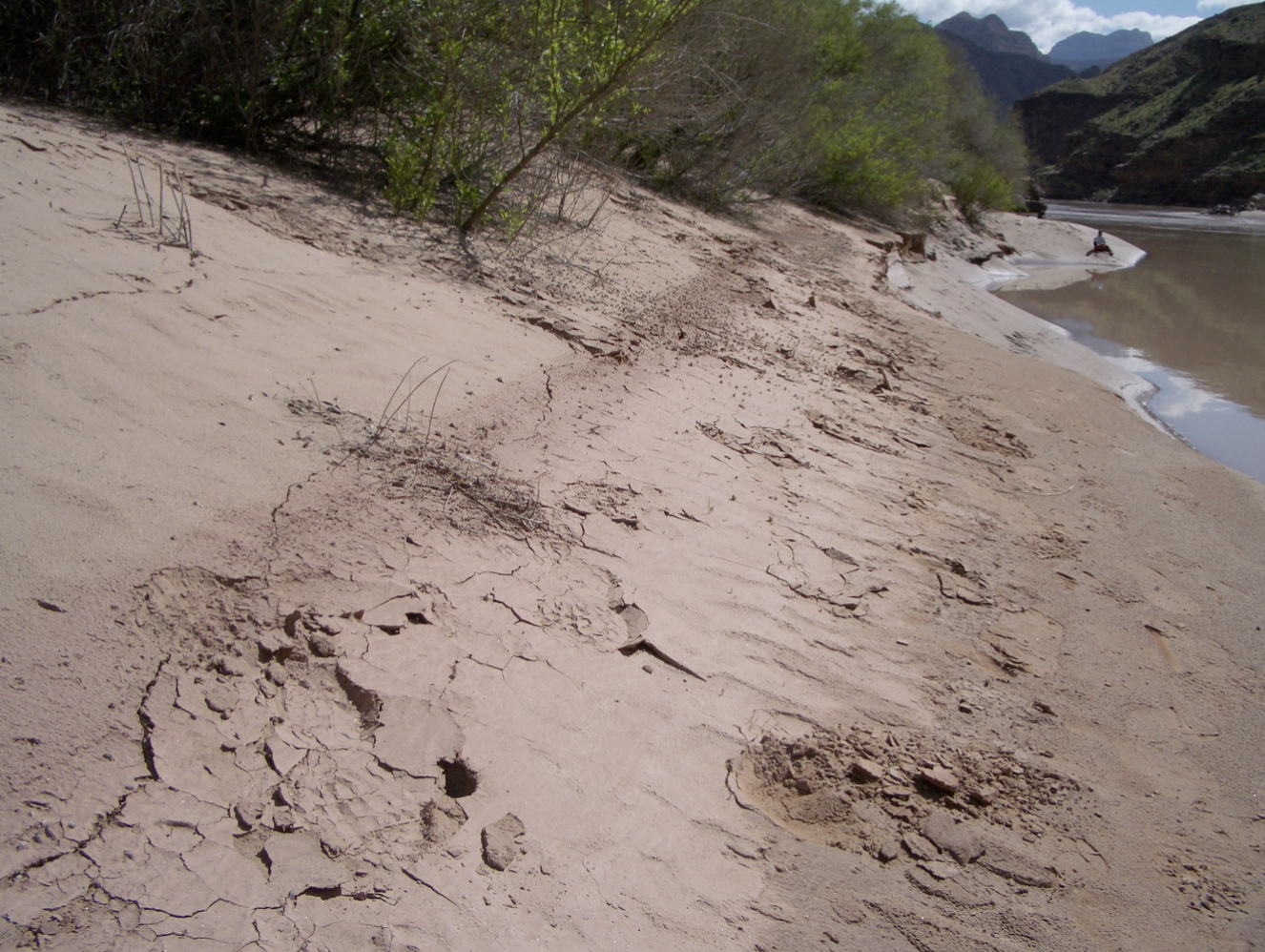
Figure 1. The mud deposit commonly seen on the sandbars of the Grand Canyon, represented by the darker band running horizontal through the upper center of the photograph. Notice the cracks caused by the drying up of the fine-grained materials of the deposit.
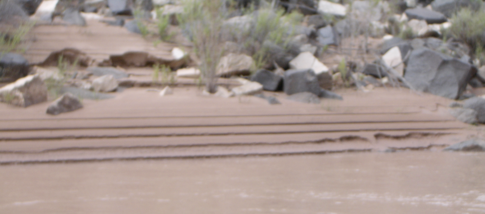
Figure 2. Horizontal striation lines frequently seen on the sandbar faces.
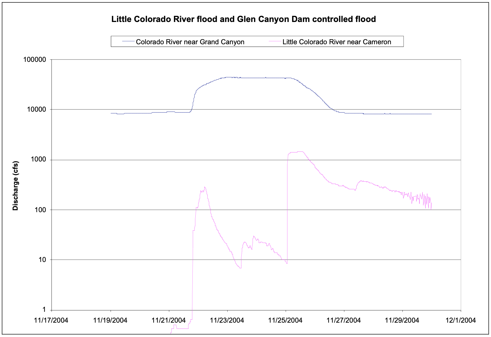
Figure 3. Hydrograph at Colorado River near Grand Canyon and Little Colorado River near Cameron. This event is hypothesized to be the cause of the mud deposit from Figure 1. Note: Discharge axis is in log-scale.