Sediment transport is observable at many locations around Santa Cruz Island. Scorpion Harbor (our home port for kayaking), Potato Harbor and Chinese Harbor are good examples you can reach on foot or by kayak. Each harbor has a different sediment supply, wave climate and beach composition that are worth checking out firsthand. This FLog focuses on Chinese Harbor, see photo 1.
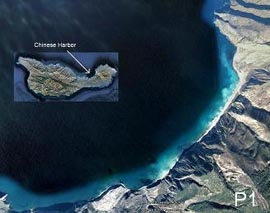
Located at the northern part of the Island's neck (photo 1 - inset) Chinese harbor is the largest beach on the Island. It sits at the base of a geologically weak rock formation (the sedimentary Monterey Formation) and receives sand and rock through landslide events and fluvial processes. On the SW and NE ends of the beach lay harder basaltic formations and deep water that prevent outside sediment from nourishing the beach. This is significant because it requires all beach material to come from rock and soil along the Harbor coastline. Furthermore, any sediment that is transported offshore is lost. In Suddeth and Burley (main report, Chapter 9) the rates of shoreline erosion are discussed with the Island's neck experiencing rapid erosion relative to other locations partly due to the sediment supply-removal imbalance.
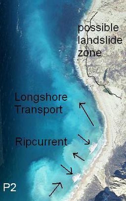
In the second photo, longshore transport is shown. It is the major sediment mover at Chinese Harbor, occurring along the length of the Harbor, and most evident at the NE corner. Sediment introduced to the surf zone through wave run-up (called swash) and wave wash-down, move sediment along the shore to the NE. This is driven by the wave direction relative to shore. Burley and Suddeth (main report, Chapter 8) give the swell direction as W-NW causing the movement of sediment NE along the beach. As the orientation of the shoreline changes (top of photo 2), the suspended sediment moves offshore. It is postulated that a landslide zone (labeled) was partly caused by an over-steepening of adjacent hillslope due to sediment removal by longshore transport.
Another sediment transport process to note in photo 2 is ripcurrent (labeled). Visible sediment plumes occur between areas of breaking waves. Ripcurrents form when waves break in a non-uniform pattern along a beach and localized wash-down paths form. This process suspends sediment and can increase the volume of sediment moved by longshore transport.
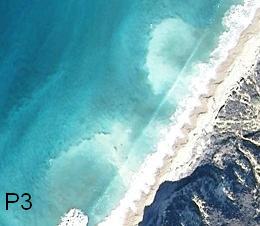
Photo 3 shows the formation of beach cusps along the shoreline. These alternating mounds of coarse material and washed out depressions are temporary, lasting hours or days. Once established they can alter swash angle and wash-back. Beach cusps are generally formed along shorelines with open ocean exposure and are sized proportionally to the incoming wave energy. The cusps found at Chinese Harbor are moderate in size, ranging from 5 to 10 meters across and less than 1 meter deep. Large cusps can have diameters of 50 meters and depths greater than a meter (Bird 2008).