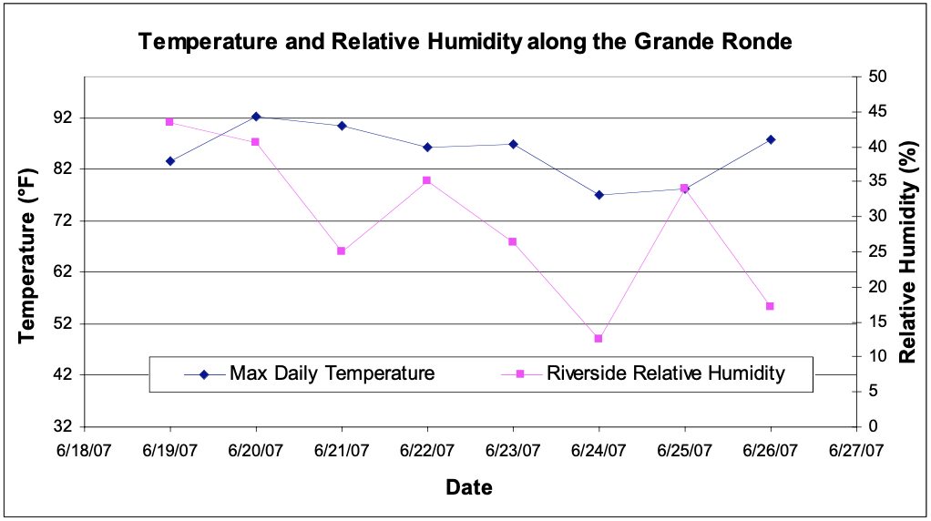
Now that the research expedition is complete, I am able to make general observations and informal conjectures about the temperature and humidity trends along our study route. In general, temperature changed in a fairly unpredictable manner, as temperature generally does over the short term, while the humidity decreased (except for during one stormy period) as we descended in elevation. The first figure below (included in our final report) shows the maximum temperatures and mean riverside humidity.
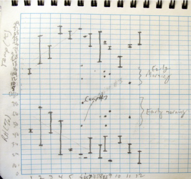
However, temperature and humidity changes are not that simple. It seems, based on my hand drawn plot of temperature and humidity ranges at each site that there were two phases of temperature, corresponding roughly to the two climatic zones we passed through (see the figure below; survey site number along the bottom). These were the upper, somewhat wetter (and greener) zone and the lower, somewhat drier (and browner) zone. As we passed through the upper zone, the temperature seems to have increased and humidity seems to have decreased with decreasing elevation fairly steadily. However, once in the lower drier zone the temperature and humidity seem much more unpredictable along the river. In general I suspect the observations are much more dependent on where (by some willows? away from the river?) and when (morning? noon? evening?) the reading is taken.
These are all interesting observations, but it would be best to take the measurements over again in a more rigorous manner in order to wean out the major variables and see if these conjectures have any validity to them or if they are merely the unique result of one short week’s worth of data.